Why Aerial Drone Photography Sells Homes 68% Faster
How does aerial drone photography help sell a home faster? The answer starts with a single statistic:
listings with aerial drone photography sell 68% faster than those with ground-level images alone. That's not
a marginal improvement, it's a compression of the entire sales cycle, the difference between an offer in
days and a listing that stagnates for weeks. Many agents still treat drone footage as a premium add-on,
something reserved for luxury properties above a certain price point. That thinking is costing them time on
market at every price tier. This article covers the data behind faster aerial-driven sales, the specific shots that convert passive
browsers into scheduled showings, the ROI math that justifies every dollar spent, and the FAA compliance
basics you need before any shoot goes live. Studios like 101 Studios have built aerial real estate
photography into their standard cinematic listing campaigns, not as an upsell, but as a core production
element. The market has moved. The question is whether your listings have moved with it. Ground-level photography does a reasonable job of capturing interiors and curb appeal. What it fails to
communicate are the factors that actually drive purchase decisions: lot scale, property boundaries, backyard
depth, neighborhood character, and proximity to parks, schools, and amenities. A wide lot reads identically
to a narrow one when every shot is taken from the driveway. Buyers are left guessing on the things that
matter most. Buyers aren't just qualifying homes; they're qualifying neighborhoods. Before requesting a showing, they
want to understand the street, the block, how close the backyard is to green space, and whether the outdoor
area is genuinely usable or a sliver of grass between fences. Aerial drone footage helps answer many of
those questions before a single showing request is made, which means the buyers who do come through the door
are already pre-qualified on location. On Zillow or Realtor.com, a drone real estate photo does something no interior image can: it stops the
scroll. In a feed of living rooms and kitchens, an aerial perspective creates instant visual contrast. That
moment of differentiation is the first conversion point in the buyer journey, and listings without it risk
becoming invisible in feeds where attention is the only resource that matters. Industry engagement data
supports this: aerial listing photos correlate with significantly higher click-through rates compared to
standard photo-only presentations. The headline figure, 68% faster sales for listings with aerial photography, comes from MLS data analyzed
across multiple U.S. markets. That number alone should reframe how you categorize drone photography in your
production budget. Beyond speed, the engagement numbers are equally significant: aerial listings generate
94% more views and 83% more website clicks compared to standard photo-only listings, according to industry
analyses of listing performance data. Aerial content doesn't just inflate view counts, it converts them into physical visits. Listings with drone
real estate photos see a 65% increase in in-person showing requests. That connection between aerial context
and visit intent is the clearest evidence that buyers use this imagery to make showing decisions, not just
browsing ones. When a buyer can see the lot, the yard, and the neighborhood from above, they arrive at
showings already committed to the property rather than still evaluating it. The National Association of Realtors reports that listings featuring aerial media close at 5-8% higher
prices on average. On a $400,000 home, that's an additional $20,000-$32,000 at closing. On a $500,000 home,
even a 1% improvement nets $5,000 above what a ground-only listing would have produced. The investment
required to generate that return is a fraction of the gain, which brings us directly to the cost side of the
equation. Understanding that aerial photography works is only part of the equation. Knowing which specific shots do
the work is what separates a productive drone session from one that produces a few striking images with no
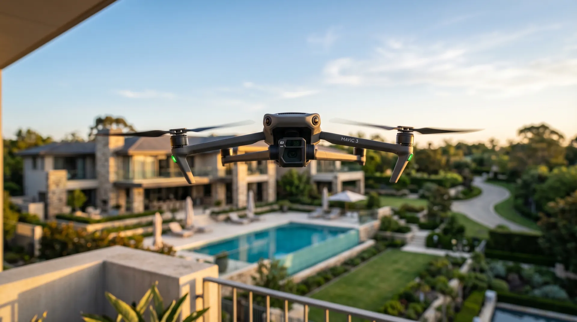
real conversion function. Every shoot should be built around a deliberate sequence of altitude, angle, and
subject. The front elevation shot, captured at approximately 50 feet, is your MLS hero image. It captures curb
appeal, facade character, and immediate surrounding context simultaneously, in a single frame that no
ground-level shot can replicate. Altitude can vary depending on airspace restrictions and property type, so
work with your operator to find the right height for each location. The top-down, 90-degree overhead
perspective is where lot size becomes undeniable: property lines, yard layout, pool placement, and overall
footprint are all visible at once, giving buyers the spatial clarity they need to commit to a visit. Oblique angles at 45 degrees and mid-altitude give the property dimension and place it in neighborhood
context, while rear elevation shots reveal backyard depth and usable outdoor space. Corner elevations expose
lot shape and the home's relationship to neighboring properties, details buyers want to assess before
booking. Together, these shots build a spatial map of the property that no interior walkthrough can provide
in advance. The highest-altitude shot in the sequence isn't really about the house; it's about the location. Proximity
to parks, water, transit, and commercial areas becomes visible from altitude in a way that no map screenshot
can convey with the same emotional weight. For out-of-area and relocation buyers especially, this overview
shot can carry exceptional persuasive power, often driving stronger engagement than multiple interior
images, particularly when the surrounding neighborhood is a key selling point. A standalone drone photography session for a residential listing typically runs $150-$400 for a licensed
operator, covering 10-20 edited aerial images. Adding a short drone video brings that to $250-$600.
Full-package campaigns that bundle property drone footage with ground photography, cinematic video, and
social-ready content range from $650-$1,500 depending on property size, market, and production scope. For
most listings, the realistic investment sits between $300 and $600 to include aerial as part of a broader
shoot. The ROI math is straightforward. At a 1% closing price increase on a $500,000 home, the seller nets an
additional $5,000. A drone package at $400 represents 8% of that single-percentage-point gain. At the
NAR-reported average of 5-8% improvement for aerial-inclusive listings, the comparison becomes almost
self-evident. The question isn't whether drone photography pays for itself; it's what leaving a
ground-level-only listing on the market costs in time, price reductions, and missed offers. 101 Studios builds aerial footage into full cinematic production campaigns, where the drone flyover opens a
property video, feeds into social reels, and connects to listing walkthroughs as a single cohesive visual
story. That integration is what converts a passive viewer into an active inquiry: every asset, from the
first aerial frame to the final social cut, tells the same story from a different angle. Isolated drone
shots perform well; cohesive real estate drone marketing campaigns perform at an entirely different level.
Professional drone work requires the right credentials, and verifying them before you book protects
everyone involved. Any drone operation conducted for commercial benefit, including real estate listings,
requires the operator to hold an FAA Remote Pilot Certificate under Part 107. Flying without this
certification constitutes illegal commercial operation, regardless of whether the photographer is directly
compensated for the drone work or packages it into a broader listing fee. Controlled airspace near airports requires prior FAA authorization, typically obtained through the LAANC
system or the FAA DroneZone portal. Temporary Flight Restrictions can ground a shoot with no notice, so
checking TFR status within 24 hours of the shoot date is standard practice for any professional operator.
Beyond federal airspace rules, many municipalities require separate commercial permits for drone operations
in parks or dense residential zones, and HOAs frequently prohibit drone flights over their communities
entirely. Checking all three layers, FAA airspace, local ordinance, and HOA rules, before scheduling a shoot
prevents costly cancellations and legal exposure. Before you hire any drone operator for a listing, ask these four questions directly: Any professional operator will answer all four questions clearly and without hesitation, ideally providing
documentation such as their Part 107 certificate, proof of insurance, and LAANC authorization for the shoot
location. If they can't, keep looking. The data makes a compelling case. A 68% faster sales cycle, 94% more listing views, 65% more showing
requests, and 5-8% higher closing prices are documented outcomes across multiple market analyses, not
results from a niche tactic reserved for eight-figure listings. They reflect what happens when aerial
footage becomes a standard production element rather than a conditional add-on. Results will naturally vary
by market, property type, and overall listing strategy, but the directional evidence is consistent. A $300-$600 investment that correlates with a 5-8% price improvement and a dramatically shorter sales cycle
doesn't require complicated justification. What requires justification is the decision to go to market
without it, especially when the cost of sitting on the market, absorbing price reductions, and losing buyer
attention to better-presented competing listings far exceeds the cost of a single drone session. The listings commanding attention in competitive markets today integrate aerial footage not as a standalone
shot but as part of a visual story. That's the approach 101 Studios applies to every production. When the
drone flyover connects seamlessly to the cinematic walkthrough, the social reel, and the pre-sale teaser,
every visual asset works together to move buyers from the first scroll to the showing request. That's not
just photography. That's a campaign, and in most cases, campaigns close faster than photo sets alone. Ready to see what aerial production looks like when it's built into a full cinematic listing campaign?
Explore 101 Studios' real estate photography and videography services or book a
consultation to discuss your next listing. 101 Studios makes every home exceptional. Cinematic photography, film, and drone that turns any Sydney listing into one buyers can't scroll past. Serving all of Sydney.What Ground-Level Photos Can't Show Buyers
The Statistics Behind Faster Sales and Higher Closing Prices
The Aerial Shot List That Moves Buyers From Scroll to Showing
What Aerial Drone Content Costs and How to Calculate Real ROI
How 101 Studios Integrates Aerial Into Full Campaigns
FAA Rules, Licensing, and What to Verify Before You Book
Airspace, Local Rules, and HOA Restrictions
Four Questions to Ask Every Drone Operator
How Aerial Drone Photography Helps Sell a Home Faster: Making It the Baseline, Not the Upgrade
Get a quote matched to your listing